
Topographic Map of Ontario - Belleville Sheet

Topographical Map of Ontario - Belleville Sheet

Plans for COR Station at Wellington

Plans for COR Station at Picton

Plans for COR Station at Picton

Plans for COR Station at Hillier

COR Station at Bloomfield Plans

Weller's and Hay Bay Islands claimed by Alnwick Indians

West Lake Islands claimed by Alnwick Indians

Road Map of Prince Edward County 1955

Hydrographic Map of Bay of Quinte, Picton to Presqu'ile Bay

Road Map of Hastings and Prince Edward Counties

Map of Prince Edward County

Map of the Counties of Hastings and Prince Edward

Map of Districts of Prince Edward and Midland

Map of District of Prince Edward County
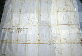
Huyck Islands claimed by Alnwick Indians

Map Hastings, Prince Edward, Northumberland and Peterborough Counties

Map of Hastings and Prince Edward Counties
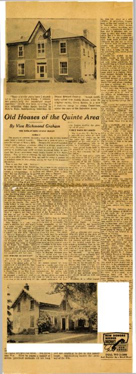
Roblin house