Showing 16726 results

Archival description
Print preview Hierarchy View:

4585 results with digital objects Show results with digital objects

Topographical Map of Whitney

A topographical map of Whitney - sheet #31 E/8. Includes Caleairy Lake, south Big Mink Lake, west Lake Louisa, and east McKenzie Lake. Composed by the Department of Natural Resources. Published by Canadian Topographic Maps in 1996. Scale 1:50,000.

Canada. Department of Natural Resources

Topographical Map of Campbellford

A topographical map of Campbellford - sheet #31 C/5. Includes Crowe Lake, south Trent River, west Asphodel Township & rast Oak Lake. Composed by the Department of Natural Resources. Published by Canadian Topographic Maps in 1994. Scale 1:50,000.

Canada. Department of Natural Resources

Air Surveys of Hastings County, Ontario

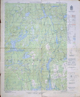
All air surveys were published in 1982. Scale 1; 10,000. By the Ontario Ministry of Natural Resources, Map base by Survey and Mapping Branch, Air Photography.

1) M470-2622. Rawdon Township Map # 10-18-2900-49050 showing areas of; the South West area of Rawdon Township, Concession 1 & 2 and Marsh Creek Watershed, Anson (Station) on the C. N. R. and part of Sidney Township, Concession 8.

2) M470-2623. Sidney Township, Map # 10-18-2900-49000 showing areas of; the Northwest area of Sidney Township being Trent River and Canal System including Wilson Island, Glen Ross, Richardson Cove, Heagles Island and South to Concession 6, Township of Sidney.

3) M470-2624. Sidney Township, Map # 10-18-2950-49000 showing areas of; Sidney Township, Concession 6, 7 and 8, Lots # 16 to 26, including part of Rawdon Creek, Oak Lake, Stirling Airfield..

4) M470-2625. Stirling, Map # 10-18-2950-4905 showing areas of; the Village of Stirling and surrounding area of Sidney & Rawdon Townships.

Ontario. Ministry of Natural Resources and Forestry

Aerial Photographs of Hastings County and surrounding areas

Reproductions of air survey photographs produced by the Ontario Ministry of Natural Resources:

1) M470-2591. Sidney Township Map # 442773E.
2) M470-2592. Murray Township Map # 442773W.
3) M470-2593. Richmond Township Map # 443771E.
4) M470-2594. Tyendinaga Township Map # 443771W.
5) M470-2595. Thurlow Township Map # 443772E.
6) M470-2596. Rawdon Township Map # 443772W.
7) M470-2597. Rawdon Township, Map # 443773E.
8) M470-2598. Seymour Township, Map # 443773W.
9) M470-2599. Sheffield Township, Map # 444771E.
10) M470-2600. Hungerford Township, Map # 444771W.
11) M470-2601. Hungerford Township, Map # 444772E.
12) M470-2602. Huntingdon Township, Map # 444772W.
13) M470-2603. Rawdon Township, Map # 444773E.
14) M470-2604. Rawdon Township, Map # 444773W.
15) M470-2605. Sheffield Township, Map # 445771E.
16) M470-2606. Hungerford Township, Map # 445771W.
17) M470-2607. Hungerford Township, Map # 445772E.
18) M470-2608. Madoc Township, Map # 445772W.
19) M470-2609. Madoc Township, Map # 445773E.
20) M470-2610. Marmora Township, Map # 445773W.
21) M470-2611. Kennebec Township, Map # 446771E.
22) M470-2612. Kaladar Township, Map # 446771W.
23) M470-2613. Elzevir Township, Map # 446772E.
24) M470-2614. Elzevir Township, Map # 446772W.
25) M470-2615. Madoc Township, Map # 446773E.
26) M470-2616. Lake Township, Map # 446773W.

Ontario. Ministry of Natural Resources and Forestry

Topographical Map of Kingston - Canada sheet

A topographical map of the area, in Canada and the USA, surrounding Kingston. The total area extends from Norwood (west) to Smith Falls (east) and Buckshot Lake (north) to Picton (south). Dated 1958-1959. Published by the Army Survey Establishment.

Donated by the Belleville Public Library in 2014.

Army Survey Establishment

Topographical Map of Belleville - Canada sheet - east half

A topographical map of Belleville - Canada sheet #31 C/3 (east half). Area extends from North-Milltown/Marysville to South-Picton and from East-Lennox and Addington to Salmon River and Big Island. Map was published by the Department of National Defence, Army Survey Establishment in 1950. Scale 1:50,000.

Donated by the Belleville Public Library in 2014.

Army Survey Establishment

Topographical Map of Tweed - Canada sheet

A topographical map of Tweed - Canada sheet #31 C/6, 7th edition. Map published by the Department of Energy, Mines and Resources, Canada in 1991. Scale 1:50,000.

Donated by the Belleville Public Library in 2014.

Canada. Department of Energy, Mines and Resources

Topographic Map of Ontario - Belleville Sheet

A map from the Eastern Canada series entitled "Topographic Map of Ontario - Belleville Sheet 31 C/3." The map includes Hastings County to Hillier in Prince Edward County. Published in 1938 by the Department of National Defence. Scale 1 inch to 1 mile.

Donated by the Belleville Public Library in 2014.

Canada. Department of National Defence

Topographical Map of Belleville, Ontario

A topographical map of Belleville - Canada sheet #31 C/3. Map was published by the Department Energy, Mines and Resources Canada in 1991. Scale 1:50,000.

Canada. Department of Energy, Mines and Resources

Topographical Map of Bannockburn - west half

A topographical map of Bannockburn - Canada sheet #31 C/12, west half. Map was published by the Department of National Defence in 1950. Scale 1:50,000.

Donated by Eric Jones.

Canada. Department of National Defence

Topographical Map of Ontario - Campbellford sheet

A topographical map of Ontario - Campbellford sheet #31 C/5. Map was published by the Department of National Defence and reprinted in 1941. Scale 1:63,360.

Donated by Eric Jones.

Canada. Department of National Defence

Topographical Map of the Belleville to Kingston

A topographical map of the area between Belleville and Kingston. The total area extends from Prince Edward County to Buckshoot Lake North & South and from Havelock to Smith Falls East and West. Dated 1935. Published by the Department of National Defense.

Donated by Eric Jones.

Canada. Department of National Defence

Topographical Map of west Trenton - Canada sheet

A topographical map of west Trenton - Canada sheet #31 C/4. Area includes the West Half of Trenton and part of Northumberland County. Map was published by the Department of National Defence in December 1962. Scale 1:50,000.

Canada. Department of National Defence

Topographical Map of Ontario - Belleville Sheet

A map of Hastings, Prince Edward, Northumberland and Peterborough counties in 1929 from the Department of Interior Canada. By J.E. Chalifour, Chief Geographer. Scale: 1" to 3.95 miles.

The legend includes additional information about counties, towns, villages, boundaries, railways, canals, lots, concessions, portages, rapids and First Nations Territories.

Canada. Department of the Interior

Maps of the National Topographic System - Index 23

  • CA ON00156 M/M470-1580 - 1584/M470-1582
  • Item
  • 31 Mar 1970
  • Part of Map collection

Canada Maps of the National Topographic System Index #23 (Ontario to Newfoundland). Dated March 31, 1970. Scale: 1:125,000.

Canada. Department of Energy, Mines and Resources

Results 121 to 140 of 16726