Showing 24 results

Archival description
Belleville Geographic features With digital objects
Print preview Hierarchy View:
Topographical Map of Ontario - Belleville Sheet
Topographical map of Belleville - west half
Topographical map of Belleville - east half
Topographical Map of Belleville - Canada sheet - east half
Topographic Map of Ontario - Belleville Sheet
South and Central Hastings Map
Meyers' Cave
Meyers' Cave
Map of Railway Station, Harbour and Wharf Facilities
Map of planned Belleville Harbour
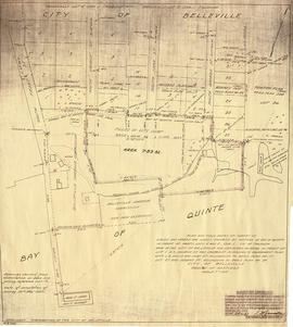
Map of Parcel of Area #1 - Land Settlement
Map of Hastings and Prince Edward Counties
Map of Dredging in Belleville Harbour
Map of City of Belleville and Principal Buildings
Map of Belleville Harbour Flood Limits and Dredging
Map of Belleville by Evans & Bolger 1877
Map of  Mouth of Moira River
Map of Mouth of Moira River
Map Hastings, Prince Edward, Northumberland and Peterborough Counties
Hydrographic Map of Upper Gap to Telegraph Narrows
Hydrographic Map of Plans in Bay of Quinte
Hydrographic Map of Belleville Bridge to Telegraph Narrows
Results 1 to 20 of 24