Water Communication between the Bay of Quinte and Lake Huron
Water Communication between the Bay of Quinte and Lake Huron

Tyendinaga Township Map # 443771W
Trenton Early History
Trenton Early History
Trent Canal : “Report on the Most Eligible Route” 1855 / N. H. Baird
Trent Canal : “Report on the Most Eligible Route” 1855 / N. H. Baird

Topographical map of Tweed - west half

Topographical map of Tweed - east half
Topographical Map of Tweed - Canada sheet
Topographical Map of Tweed - Canada sheet

Topographical map of Tweed - Canada sheet

Topographical map of Trenton - Canada sheet

Topographical Map of Ontario - Belleville Sheet
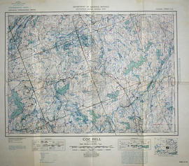
Topographical map of Coe Hill, Ontario
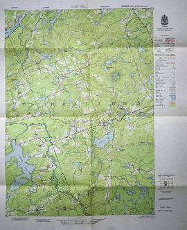
Topographical map of Coe Hill - west half
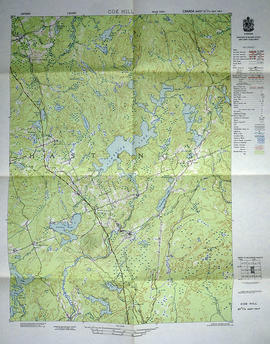
Topographical map of Coe Hill - east half
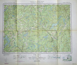
Topographical map of Coe Hill - Canada sheet

Topographical map of Belleville - west half

Topographical map of Belleville - east half

Topographical Map of Belleville - Canada sheet - east half

Topographical map of Bannockburn - Canada sheet

Topographical map of Bancroft - west half

Topographical map of Bancroft - west half