
- CA ON00156 TR/3716
- File
- c. 1880
File contains a diagram of Lot 19 Con. I, Twp of Madoc, Co. Hastings. Shows plots and names of owners. Names include Griffin, Broad, Morrison, Ferguson, and Hobson.
36 results with digital objects Show results with digital objects
File contains a diagram of Lot 19 Con. I, Twp of Madoc, Co. Hastings. Shows plots and names of owners. Names include Griffin, Broad, Morrison, Ferguson, and Hobson.
Entry for Adult Writing Contest by Elizabeth Cooper. Includes statistics and sketches. 18 pages.
Gordon, Sandi "Pineview School" S.S. #5, Elzevir Twp. H.C.H.S. Student Essay Contest
A report on the Pineview School written by 6th grader Sandi Gordon for Madoc Township. Includes photographs and maps. 16 pages.
Rebecca Best "House Log" for Home in Elzevir Twp. Con. III Lot 16
A history of a lot in Hastings County written by 5th grader Rebecca Best for Madoc Township. Includes photographs. 12 pages.
Sarah Ketcheson "The History of Pitts Landing" H.C.H.S. Essay Contest Entry
An essay written by 5th grader Sarah Ketcheson on the history of Pitts Landing in Madoc Township for a contest. Includes photographs. 17 pages.
The file contains land records as follows:
File contains manuscript quit claims and deeds concerning the following properties:
i) part of lot number nine, eighth concession, Township of Marmora, purchased by James Madison Tuttle and Laura Maria Tuttle from Richard O. Rothwell, 30 May 1877;
ii)-west half of lot number sixteen in the fifth concession of the Township of Madoc purchased by George Dean Dickson and Marian Ellen Wilson Dickson from Thomas Comerford, 2 December 1882;
iii)-five acres on lot fifteen, fifth concession in the Township of Madoc, purchased by Thomas Comerford from David Pitceathly, Thomas Kelso et al, 11 June 1884;
McFee Papers : mining 1840-1889
File contains manuscript assignments of mortgages, indentures of sale and conveyance of mineral rights of the McFee Family of Belleville regarding properties in Madoc and Marmora Townships.
File contains a newspaper clipping and photocopied manuscript history of Madoc Township from early French exploration in 1615 to ca. 1965, including a discussion of the creation of roads, schools and local churches. The historical research was composed by Mrs. Ken Bateman for Gerry Boyce as background for Historic Hastings.

Madoc Township : history of Bannockburn
File contains original and photocopied manuscript histories of the settlement and early development of Bannockburn including the lumbering and sawmilling industries. Includes a printout of a webpage on Maitland House (available on the Internet Archive's Wayback Machine at https://web.archive.org/web/20010805101431/http://casa-de.vrx.net/buildings/) and an article from the Fall 2019 Country Roads magazine about the conversion of St. Bartholomew Anglican Church in Bannockburn into a private home.

Madoc : Hannah family genealogy
File contains a typescript extract from the Hastings County Court Registry Office concerning the ownership of a piece of land in Madoc Township, granted to C. Gordon Hannah in 1861. The lot is not identified, but information from the land index maintained by the Marilyn Adams Genealogical Research Centre suggest that it is lot 24 in the seventh concession of Madoc Township.
Madoc Township : certification of assessment, 1865
File contains a manuscript certification of assessment of the number of householders in Madoc Township in 1865 sufficient to warrant the election of a deputyreeve.
Madoc Township : surveyors' field notes, 1867-1891
File contains micro-copied manuscript field notes Provincial Land Surveyor, H.A. F. MacLeod, concerning concessions and boundaries of Madoc Township, Hastings County in 1867. Also contains micro-copied manuscript field notes on a survey undertaken by C. F. Aylsworth, P.L.S. of Madoc Township in 1891.
Election Canada Districts in Centre Hastings
Part of Map collection
2 copies of maps detailing electoral districts #40 to 45 (inclusive) within Centre Hastings. The map includes polling divisions, road networks and municipal boundaries. Inset # 2, # 35073.
Canada. Department of Natural Resources
Aerial Photograph of Madoc Township
Part of Map collection
Madoc Township, north part Bannockburn with Hwy 62, the railway, and the Bannockburn Road running east toward Cooper. By the Air Photographic Production Division of the Deptartment of Mines & Technical Surveys - Government of Canada.
Canada. Department of Mines and Technical Surveys
Aerial Photograph of Madoc Township
Part of Map collection
Madoc Township, Map # A18256-148 showing areas of Hwy 62 at Bannockburn and the road east to Cooper. The railway parallel with Hwy 62. The Ontario Hydro easement running west from Cooper. By the Air Photographic Production Division of the Deptartment of Mines & Technical Surveys - Government of Canada.
Canada. Department of Mines and Technical Surveys
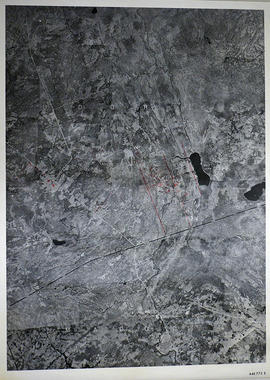
Part of Map collection
A reproduction of an air survey photograph produced by the Ontario Ministry of Natural Resources. Map #446773E of Madoc Township in Hastings County, Ontario. Circa 1950.
The photograph shows the northern part of Madoc Township, Bannockburn, Tudor Township, Concession 1 to 9, Robinson Lake, Westerly to Millbridge, Moira River, Highway 62, and the Canadian National Railway.
Donated by Walter I. Watson, P.L.S.
Ontario. Ministry of Natural Resources and Forestry

Part of Map collection
A reproduction of an air survey photograph produced by the Ontario Ministry of Natural Resources. Map #445772W of Madoc Township in Hastings County, Ontario. Circa 1950.
The photograph shows Madoc Township, Concession 5 to 9, Huntingdon Township Concession 14, northwest Elzevir Township, Queenboro and Black River.
Donated by Walter I. Watson, P.L.S.
Ontario. Ministry of Natural Resources and Forestry

Part of Map collection
A reproduction of an air survey photograph produced by the Ontario Ministry of Natural Resources. Map #445773E of Madoc Township in Hastings County, Ontario. Circa 1950.
The photograph shows Madoc Township, Concession 1 to 7, Hwy 62, and Moira River Watershed, Eldorado, Lake Township, Concession 3 to 10.
Donated by Walter I. Watson, P.L.S.
Ontario. Ministry of Natural Resources and Forestry

Plans for St Peter's Presbyterian Church
Part of Map collection
A set of plans for St. Peter's Presbyterian Church in Madoc, Hastings County, Ontario. The church itself opened in 1850. Scale: 8 feet : 1 inch.
Reproduction from the Archives of Ontario.