Showing 4 results

Archival description
Huntingdon, Township of Transportation and utilities
Print preview Hierarchy View:

3 results with digital objects Show results with digital objects

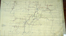
Hydro-Electric Power Commission of Ontario, Tweed Section

  • CA ON00156 M/M430-2995 - 2996, 3018 - 3021, 3031/3021
  • Item
  • 16 Oct 1951
  • Part of Map collection

An original map produced for the Hydro-Electric Power Commission of Ontario, concerning hydro power lines, stations and transformers. However, the map also features railways, roads and land boundaries.

This map is of the Southwest Section - Tweed Rural Power District. The total area includes parts of Hungerford, Huntingdon, and Thurlow Townships. Dated October 16, 1951. Scale: 2 inches = 1 mile.

Donated by David Pershik.

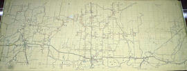
Hydro-Electric Power Commission of Ontario, Frankford Section

  • CA ON00156 M/M430-2995 - 2996, 3018 - 3021, 3031/3020
  • Item
  • c. 1950
  • Part of Map collection

An original map produced for the Hydro-Electric Power Commission of Ontario, concerning hydro power lines, stations and transformers. However, the map also features railways, roads and land boundaries.

This map is of the North Section - Frankford Rural Power District. The total area includes parts of Thurlow, Huntingdon, Sidney, Rawdon, Campbellford, Seymour, Brighton, and Percy Townships. Circa 1950.
Donated by David Pershik.

Hydro-Electric Power Commission of Ontario, Tweed-Section

  • CA ON00156 M/M430-2995 - 2996, 3018 - 3021, 3031/3018
  • Item
  • 16 Oct 1951
  • Part of Map collection

An original map produced for the Hydro-Electric Power Commission of Ontario, concerning hydro power lines, stations and transformers. However, the map also features railways, roads and land boundaries.

This map is the West Centre Section - Tweed ROA. The total area includes parts of Rawdon, Marmora, Huntingdon, Madoc, Hungerford, and Elzevir Townships. Dated October 16, 1951. Scale: 1.2 inches = 1 m.

Donated by David Pershik.