Showing 27 results

Archival description
Map collection Rawdon, Township of With digital objects
Print preview Hierarchy View:
Hydro-Electric Power Commission of Ontario, Rawdon Section
Subdivision of Lots 13-21 in the village of Stirling
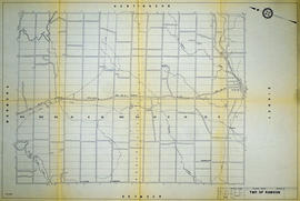
Subdivision of Park Lots 1-2 in the Township of Rawdon
Rawdon Township Map # 444773E
Rawdon Township Map # 444773W
Hydro-Electric Power Commission of Ontario, Frankford Section
Rawdon Township Map # 443773E
Rawdon Township Map # 443772W
Hydro-Electric Power Commission of Ontario, Bonarlaw Section
Lloyd's Map of Hastings County
Map of Hastings with townships
Map of the Counties of Hastings and Prince Edward
Plan of the village of Springbrook
Map of Hastings with the Principal Villages and the City of Belleville
Plan of Wellington Block in the village of Stirling
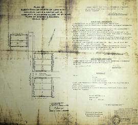
Plan of Park Lots 13-14 in the village of Stirling
Hastings with Town of Belleville and principal villages
Plan of Hastings for Hastings Directory
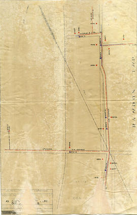
Plan of park lots on Lots 10-11 in Rawdon Township
Plan of Allan's Block in the village of Stirling
Results 1 to 20 of 27