Affichage de 529 résultats

Description archivistique
Transportation and utilities
Aperçu avant impression Hierarchy Affichage :

116 résultats avec objets numériques Afficher les résultats avec des objets numériques

Map of Wollaston Township

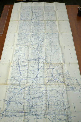
  • CA ON00156 M/M420-2169 - 2183/M420-2175
  • Pièce
  • c. 1880
  • Fait partie de Map collection

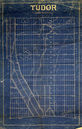
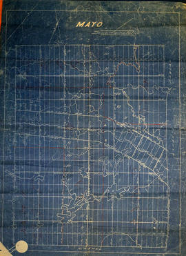
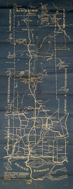
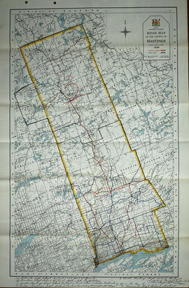
A blueprint reproduction of a map of Wollaston Township in Hastings County, Ontario. The map features the names of neighboring townships, lot and concession numbers, rivers, lakes, and the Central Ontario Railway. Original map circa 1880. Scale 40 chains to an inch.

Map of Tudor Township

  • CA ON00156 M/M420-2169 - 2183/M420-2172
  • Pièce
  • c. 1865
  • Fait partie de Map collection

A blueprint reproduction of a map of Tudor Township in Hastings County, Ontario. The map features the names of neighboring townships, lot and concession numbers, rivers, lakes, creeks and meadows. Original map circa 1865. Scale 40 chains to an inch.

Map of Mayo Township

  • CA ON00156 M/M420-2169 - 2183/M420-2171
  • Pièce
  • c. 1865
  • Fait partie de Map collection

A blueprint reproduction of a map of Mayo Township in Hastings County, Ontario. The map features the names of neighboring townships, lot and concession numbers, rivers, lakes and school sections in red. Circa 1865. Scale 40 chains to an inch.

Map of Mayo Township

  • CA ON00156 M/M420-2169 - 2183/M420-2170
  • Pièce
  • c. 1890
  • Fait partie de Map collection

An original waxed linen map of Mayo Township in Hastings County, Ontario. The map features the names of neighboring townships, lot and concession numbers, and lakes. Signed by a “J. E. Appleby” of Toronto. Circa 1890.

Map of Madoc Township

  • CA ON00156 M/M420-2169 - 2183/M420-2169
  • Pièce
  • c. 1880
  • Fait partie de Map collection

A blueprint reproduction of a map of Madoc Township in Hastings County, Ontario. The map features the names of neighboring townships, lot and concession numbers, Central Ontario Railway, Moira River, a mill site and springs. Circa 1880. Scale 40 chains to an inch.

The 'Monck' Road : colonization road, 1863

File contains newspaper articles concerning the history of the Monck Road, a colonization road primarily, but also intended as a less vulnerable military route between the Upper Great Lakes and the Ottawa Valley, passing near Bancroft, Ontario. The road was surveyed in 1864-1865 and named in honour of Governor-General, Lord Monck. Also included is typescript transcript of an article entitled "Was the Monck Road for Military Use?" / by Dr. J. J. Talman, first published in the Orillia Packet and Times, 27 June 1940

Map of Hastings County and Road Changes

  • CA ON00156 M/M420-1658
  • Pièce
  • Jun 1915
  • Fait partie de Map collection

A map of Hastings County in 1914. Roads to be removed are highlighted in red colour. Published by the Office of Public Roads and Highways. Scale: 2 miles = 1". Dimensions: 54cm x 87cm.

Donated by Eric Jones, accession #2015-49.

Sans titre

Map of Hastings County

A map of Hastings County with major roads, settlements, waterways and railroads. Circa 1930. Portions of adjoining counties are also shown.

Donated by Nick January in 2016.

Road Map of Hastings County 1949

A road map of Hastings County in 1949. Portions of adjoining counties are also pictured. Boundaries are yellow, while roads are blue and red. Published by the Ontario Department of Highways. Scale: 1 inch = 4 miles.

Donated by Nick January of the Hastings County Planning and Development Department in 2016.

Sans titre

Map of Hastings County with New Road System

  • CA ON00156 M/M420-2163
  • Pièce
  • 1914 - 1 Jul 1925
  • Fait partie de Map collection

A map of Hastings County, with its 24 townships, in 1914. Superimposed on top is the New Road System as of July 1, 1925. The map features lots, concessions, locks, settlements, water ways and railroads. Published by the Office of Public Roads & Highways of Ontario.

Donated by Nick January of the Hastings County Planning and Development Department in 2016.

Sans titre

Copy of a Map of the Province of Ontario showing Railways

  • CA ON00156 M/M400-2282
  • Pièce
  • 1884 - Jan 1997
  • Fait partie de Map collection

A reproduction of a "Map of the Province of Ontario Showing Railways now Running." A series of Toronto business advertisements line the bottom of the map. Originally published by the Canadian Almanac in 1884. Reproduced by COPP Clark Professional in January 1997 for the celebration of 150 continuous years of almanac and directory publishing.

Donated by the Belleville Public Library in 2014.

Sans titre

Railways and Canals of Eastern and Western Canada

  • CA ON00156 M/M400-2253 and 2254
  • Pièce
  • 1972
  • Fait partie de Map collection

1) A map of the Railways and Canals of Eastern Canada in 1971. Index #203 and 204 as published by the Department of Energy, Mines and Resources. Scale 1:7,500,00 or one inch to 118.37 miles. Includes area from Ontario to Newfoundland.

2) A map of the Railways and Canals of Western Canada in 1971. Index #205 and 206 as published by the Department of Energy, Mines and Resources. Scale 1:7,500,00 or one inch to 118.37 miles. Includes area from British Columbia to Ontario.

Sans titre

Reproduction Map of Canada and Nova Scotia

A reproduction of a Canada and Nova Scotia Map by John Thomson. Original map made in 1821 and held at the Archives of Ontario. Scale: British Statute Miles 69 1/2 to a Degree.

Sans titre

Road Map of Hastings County 1978

  • CA ON00156 M/M430-2431
  • Pièce
  • Feb 1978
  • Fait partie de Map collection

A road map of Hastings County in 1978. Portions of adjoining counties are also pictured. Boundaries are yellow, while roads are blue and red. Published by the Ontario Ministry of Transportation and Communications.

Donated by the Belleville Public Library in 2014.

Sans titre

Map of Southern Hastings County 1990

A map of the County of Hastings, Southern Portion, County Seat - Belleville. Published by the Ministry of Transportation and Communications, Ontario, in 1990.

Features: road jurisdictions, Kings Highways, secondary highways, township roads, roads legally open but not necessarily passable, urban corporate limits, railways and stations, township boundaries, county boundaries, populated areas.

Donated by the Belleville Public Library in 2014.

Sans titre

Map of Middle Hastings County 1980

A map of the County of Hastings, Middle Portion, County Seat - Belleville. Published by the Ministry of Transportation and Communications, Ontario, in 1980.

Features: road jurisdictions, Kings Highways, secondary highways, township roads, roads legally open but not necessarily passable, urban corporate limits, railways and stations, township boundaries, county boundaries, populated areas.

Donated by the Belleville Public Library in 2014.

Sans titre

Comfort Country Map of Hastings County

  • CA ON00156 M/M430-2430
  • Pièce
  • 2006-2007
  • Fait partie de Map collection

A excerpt map from a news paper. The map is entitled "Comfort Country" and highlights vacation areas in Stirling, Tweed, Madoc, Marmora. Advertisements on back with numbers to show on Map where it is located.

Map of Hastings County with advertisements 1980

A presumed photocopy of a map of the County of Hastings, with advertisements, in 1980. Published by Graphic Publishers (Canada) of Toronto.

Donated by the Belleville Public Library in 2014.

Sans titre

Résultats 121 à 140 sur 529