Showing 1531 results

Archival description
Land, settlement and immigration
Print preview Hierarchy View:

883 results with digital objects Show results with digital objects

Donnan Family Collection

The file contains these items:
1) 1830 Indenture - Christopher Lenox to John L.W. Meyers, mortgage to Edward Fidlar - Huntingdon Twp, Con 4., Lot 1, 100 acres
2) 1832 Sale - John L.W. Meyers to Jonathan Horton - Huntingdon Twp, Con 4., Lot 1, 100 acres
3) 1840 Certificate of Jonathan Horton, appointing Hiram Nelson of Belleville as his attorney in seeking a grant of land for his service in the Hastings Militia in the War of 1812
4) 1840 Certificate of Benjamin Ketcheson asserting that Jonathan Horten served in the militia between October 1812 and August 1813
5) 1844 Sale - David Adams to John King Fairfield - Rawdon Twp., Con 4, Lot 3
6) 1855 & 1872 Deed & Release - Paul Kingston, Jonathan & Elijah Horton, Samuel Horton - Rawdon Twp., Con. 4, Lot 2, 100 acres
7) 1894 Declaration - George Allan Kingston of Charles Kingston - Rawdon Twp., Con. 4, Lot 2, 100 acres
8) 1903 Deed - Eliza S. McInroy to Alexander McInroy - Huntingdon Twp., Con. 4, Lot 1, 25 acres
9) 1915 Order & Letter - winding up estate of late Hiram Horton
10) 1944 Deed - Alexander McInroy to John & Eliza Matilda McInroy - Rawdon Twp., Con. 3, Lot 3; Rawdon Twp., Con. 3, Lot 4; Huntingdon Twp., Con. 7, Lot 15
11) 1952 Deed Frederick George Kent & wife Daisy Julia Kent to William F. Maynes - Huntingdon Twp., Con. 7, Lot 15; Stirling Twp., Baker Street lots
12) 1964 Deed - Corporation of Village of Stirling to Florence Laney - Stirling Twp., Emma Street lot
13) 1965 Mortgage - Florence Laney to George & Mary Hicks - Stirling Twp., Emma Street lot
14) 1965-1966 Tax Demands to Florence Laney - Stirling Twp., 30-Emma Street

Ponton, Mungo : Crown grants

File contains a printed completed oath of allegiance sworn by Mungo Ponton before the Upper Canada Commissioner for the taking of oaths, on 13 August 1841. Also present is a manuscript letter from E.Mahon to Mungo Ponton concerning an application by the latter for land in the Township of Seymour, Northumberland County, 30 August 1831; and a printed, completed deed of land granted on 22 July 1841 to Mungo Ponton for a tract of four hundred acres, at lot number 8, in the 7th concession and lot number 8, 8th concession in the Township of Seymour, Northumberland County.

Ponton (family)

Map of Proposed bridge at mouth of the River Trent

A copy of an original map by N. H. Baird showing a harbour and bridge proposal at the Mouth of the River Trent - October 26, 1832.
Photocopied by the Archives of Ontario.

Baird, Nicol Hugh

Robertson, William, Postmaster, Port Trent, 1832-1836.

File contains manuscript statements of accounts and correspondence originating from and received by William Robertson, Postmaster, Port Trent concerning land transactions. Also present are printed completed receipts issued by the Commissioner of Crown Lands' Office, Peter Robinson issued in 1834 for lands sold from the Clergy Reserves in the township of Murray, district of Newcastle.

Robertson, William; Port Trent Letters 1833, 1840, 1845, 1851

File contains manuscript correspondence originating from and received by William Robertson regarding lands at River Trent in Murray Township. Also present is a completed, printed approval of the Board of Endowment Office, Toronto, of an application for purchase of lot 28, concession 3, Township of Murray by William Robertson, 29 August 1851.

Fidlar, Edward, Rawdon 1834

File contains original manuscript mortgage registration for a mortgage held by William Robertson on a property in Stirling, Rawdon Township, purchased by Edward Fidlar. Also contains a manuscript and printed indenture of bargain and sale between Edward Fidlar and Simon Root for land in the village of Stirling.

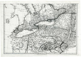
Map of Upper Canada and United States

A map showing settlements of Upper Canada and part of the United States in 1834 by J. Arrowsmith.
Received from the Archives of Canada's map collection - July 9, 1971.

Arrowsmith, John

Parts of Ontario and USA in 1834

A map showing settlements of Ontario and part of the United States in February 1834 by J. Arrowsmith. The total area extends from Lake Huron East to Montreal and south Ohio to Long Island.
Received from the Archives of Canada's map collection - 11 May 1977.

Arrowsmith, John

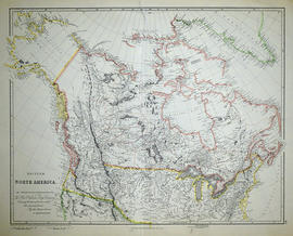
Map of British North America

A reproduction by the Canadian Department of Energy, Mines and Resources of "British North America by Permission dedicated to The Honorable Hudsons Bay Company containing the latest information which their documents furnish by their obedient servants." The map was originally composed by John Arrowsmith in 1834.

Donated by Gerry Boyce.

Arrowsmith, John

Map of District of Prince Edward County

Map showing townships in the District of Prince Edward County: South Murray, Sidney, Thurlow, Ameliasburgh, Sophiasburgh. See boundary lines on map. Surveyed by Publius Virgillius Elmore, D.L.S. Dated 1835. Map copied from the Archives of Ontario.

Elmore, Publius Virgillius, D.P.S.

Results 101 to 120 of 1531