Showing 900 results

Archivistische beschrijving
With digital objects
Print preview Hierarchy View:
Plan of Subdivision of Lot 5 in Canniff's Mills
Wallbridge Lease of Indian Lands in Tyendinaga
Survey of the First Loyalists Settlement
Reproduction of a plan of the organized part of the Provinces of Upper Canada
Map of the Belleville Main Arteries
First Floor Plan at County Court House
Cell Block and Basement Plans at Court House
Weller's and Hay Bay Islands claimed by Alnwick Indians
West Lake Islands claimed by Alnwick Indians
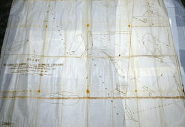
Huyck Islands claimed by Alnwick Indians
Land Settlement Map of the Moira Valley
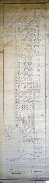
Plan of Part of the Town of Belleville
Map of the County of Hastings and Adjoining Townships
Philips' School-room Map of Europe
Regional Plan 411 of Lots in Bancroft
Map of the Province of Ontario
Road Map of Hastings County 1956
Map of the Counties of Hastings and Prince Edward
Map of the Province of Ontario in counties and districts
Topographical Map of Belleville - Canada sheet - east half
Resultaten 81 tot 100 van 900