Showing 1278 results

Archival description
Map collection Canada
Print preview Hierarchy View:

891 results with digital objects Show results with digital objects

Map of Belleville Streets with advertisement sponsors

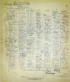
A map featuring the streets in the City of Belleville, as well as important buildings (e.g. schools, churches etc.). Sponsored by and featuring advertisements from McDonald's, Four Seasons Sports, National Real Estate Service, Lester's Restaurant and Petro-Canada.

Tourist Map of Belleville to Brockville

A map featuring the towns, cities and major tourist attractions from Belleville to Brockville. Sponsored by Rideau Marina Kingston Ltd, Atlantis Direct Marketing Inc., and CKWS television. On the reverse - brief explanations of the major cities/towns.

Discovery Tour of Loyalist Country (pamphlet)

A pamphlet describing a 250km tour of historical attractions within Hastings, Prince Edward, Lennox and Addington counties. The history of each destination (e.g. the Macpherson House) is given, as well as its location on a map.

Ontario Heritage Foundation

Pathfinder's Map of Belleville 1963

A map of the City of Belleville in Hastings County, Ontario. Composed and published by Pathfinder Air Surveys Ltd., in 1963.
Insets include:
1) Street index
2) Industries index
3) Businesses and services index
4) Legend
5) List of cities with Pathfinder map suppliers
6) Survey information

Pathfinder Air Surveys Ltd.

Geological Map of the Madoc and Gananoque areas

2 maps showing geological areas in Madoc (Map No. 2053) and Gananoque (Map No. 2053). Scale 1 in to 2 miles. Booklet by D. F. Hewitt, Senior Geologist, Ontario Department of Mines, Toronto.

Ontario. Ministry of Natural Resources and Forestry

Flood Risk Maps of the Lower Trent Region

7 flood risk maps for the Lower Trent Region. Part of the Canada-Ontario Flood Damage Reduction Program.

Ontario. Ministry of Natural Resources and Forestry

Minerals of Ontario

A double sided, folded map showing the location and types of mineral in Ontario. The back side shows photographs of each type of mineral. Published by the Ministry of Industry & Tourism and Ministry of Natural Resources.

Ontario. Ministry of Natural Resources and Forestry

See Ontario By Air

"See Ontario By Air" - a double sided, folded map showing the location and amenities surrounding airports in southern and northern Ontario.

Ontario. Ministry of Transportation

Map of Ontario Geology and Principal Minerals

A double-sided map of Ontario Geology and Principal Minerals. The inside discusses information, research and statistics of minerals found in Ontario. The map shows where the minerals are found in Ontario. Published by the Ontario Dept. of Mines and Northern Affairs in 1970.

Ontario. Department of Mines

Road Map of the Province of Ontario 1967

A road map of the northern and southern portions of the Province of Ontario. Published by the Ontario Department of Highways in 1967 for the Centennial Year. Various indexes and legends are located on the map.

Ontario. Department of Highways

Road Map of the Province of Ontario 1956

A road map of the northern and southern portions of the Province of Ontario. Published by the Ontario Department of Highways in 1956. Various indexes and legends are located on the map.

Ontario. Department of Highways

Road Map of the Province of Ontario 1953

A road map of the northern and southern portions of the Province of Ontario. Published by the Ontario Department of Highways in 1953. Various indexes and legends are located on the map.

Ontario. Department of Highways

Reproduction Map of Principal Communications in Canada West

A reproduction made in 1971 of the Hastings and Prince Edward sections of a Map of the Principal Communications in Canada West by Major Baron de Rottenburg. Original map made in 1850 and held at Library and Archives Canada. Scale 2 miles to an inch. Each of the sheets provides a close look at the roads, lands and lighthouses in the townships and districts at the time. Library and Archives Canada reference: http://central.bac-lac.gc.ca/.redirect?app=fonandcol&id=4138509&lang=eng

DeRottenburg, Major Baron

Map by the Bancroft Mineral Society

A map of the highways, gravel roads, towns and mineral deposits located in the town of Bancroft and the surrounding area. Published by the Bancroft and District Chamber of Commerce. On the reverse side is the key to the numbered mineral deposits - types of minerals and the exact location/owner.

Bancroft and District Chamber of Commerce

Road Map of Hastings County 1953

A road map of Hastings County in 1953. Portions of adjoining counties are also pictured. Boundaries are yellow, while roads are blue and red. Published by the Ontario Department of Highways. Scale: 1 inch = 4 miles.

Ontario. Department of Highways

Map of Sidney Township in 1787 - 1981 rewrite

A recopy of the 1787 map of Sidney Township. The original map entitled "Plan of the Township of Sidney in the District of Mecklinburg. Surveyed in 1787 by Lewis Kotts, with the names of the proprietor inserted in the Lots." The recopy was completed by Mrs. Dorothy Ashton in 1981, for the Corby Public Library and Hastings County Historical Society. Scale 40 chains to an inch.

Donated by the Belleville Public Library in 2014.

Kotte, Lewis

Re-subdivision of Lot 8 in the City of Belleville

A certified reproduction of the "Re-subdivision of portions of MacDonald and Maud Plans, now the property of the Burrell Rock Drill Company & others, being part of the west half of Lot # 8, Concession 1, Township of Thurlow.” Surveyed by Henry Carre O. L. S., and signed April 29, 1910.

This copy was made in 1972 of plan #391, as registered in the Hastings Land Registry Office.

Donated by Walter I. Watson, P. L. S.

Carre, Henry, O.L.S.

Results 81 to 100 of 1278