Showing 588 results

Archival description
Hastings, County of Government
Print preview Hierarchy View:

109 results with digital objects Show results with digital objects

Map of Napanee Administrative District 1980

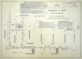
A map of the Napanee Administrative District including Northumberland, Hasting County, Prince Edward County, Lennox Addington counties. Published by the Ministry of Natural Resources in 1980.

Donated by the Belleville Public Library in 2014.

Ontario. Ministry of Natural Resources and Forestry

Road Map of Hastings County 1972

A road map of Hastings County in 1972. Portions of adjoining counties are also pictured. Boundaries are yellow, while roads are blue and red. Published by the Ontario Department of Transportation and Communications.

Donated by the Belleville Public Library in 2014.

Ontario. Ministry of Transportation

Map of Northern Hastings County 1980

A map of the County of Hastings, North Portion, County Seat - Belleville. Published by the Ministry of Transportation and Communications, Ontario in 1980.

Features: road jurisdictions, Kings Highways, secondary highways, township roads, roads legally open but not necessarily passable, urban corporate limits, railways and stations, township boundaries, county boundaries, populated areas.

Donated by the Belleville Public Library in 2014.

Ontario. Ministry of Transportation

Map of Northern Hastings County 1971

A map of the County of Hastings, North Portion, County Seat - Belleville. Published by the Ministry of Transportation and Communications, Ontario. Revised in February 1971.

Features: road jurisdictions, Kings Highways, secondary highways, township roads, roads legally open but not necessarily passable, urban corporate limits, railways and stations, township boundaries, county boundaries, populated areas.

Donated by the Belleville Public Library in 2014.

Ontario. Ministry of Transportation

Research Project of the Wards in Belleville

A part of a research project studying the evolution of wards in Belleville, from 1836 - 1874. The wards are coloured in on Charles Mott's map of the City of Belleville (circa 1950).

Donated by the Belleville Public Library in 2014.

Belleville Public Library

Floor Plans of Jail at County Court House

A plan of the Jail at the Hastings County Court House on Pinnacle Street in Belleville, Ontario. Sheet 1 features old cells and kitchen in basement. Sheet 2 features jail cells in the southeast jail building. Composed by Charles A. Mott, City Engineer, and dated January 1928.

Donated by Heritage Belleville in 2017.

Campbell, Charles Donald, O.L.S.

Layout of Buildings at County Court House

A General Layout of the Buildings at the Hastings County Court House on Pinnacle Street in Belleville, Ontario. All buildings are named. Composed by Charles D. Campbell, O.L.S, and dated October 16, 1927.

Donated by Heritage Belleville in 2017.

Campbell, Charles Donald, O.L.S.

Seating (and Apartment) Plans at Belleville City Hall

A seating plan of the auditorium at Belleville City Hall, drawn in ink. Composed by Charles A. Mott, City Engineer, in February of 1924. The plan features the stage, council chambers and offices. Super-imposed on the plan (in pencil) is the layout of 4 apartments. They were used in 1946 during an acute housing crisis, to house 4 different families. The council at the time agree to the idea and allowed them to stay for almost 2 years.

Donated by Heritage Belleville in 2017.

Mott, Charles Allan

Second Floor Plan at Belleville City Hall

A blueprint of the second floor at Belleville City Hall, created February 2, 1932, by "H.E.P.C. of O., Illumination Laboratory." The plan features the auditorium, council chambers, offices, luminaries and typical windows.

Donated by Heritage Belleville in 2017.

Topographical and Boundary Maps of Belleville

Two photocopies of maps showing the buildings and topographical lines with the boundaries of the City of Belleville.
Includes: the Bay of Quinte north to Hwy 401 and from Avonlough Road east to Bell Creek.

Quinte Planning Board

Subdivision of part of Lots 23-25 in the Township of Tudor

A certified reproduction of the "Subdivision of part of Lots # 23, 24, 25, Concession XIX, Township of Tudor.” The area includes; Lots # 1 to 28, Blocks A - B and Austin Bay Road along the shore of Bass Lake in Lot # 25, Concession XIX, Tudor Township. Surveyed by Thomas Ransom, O. L. S. and signed August 30, 1961.

Donated by Walter I. Watson, P. L. S.

Ransom, Thomas Saunders, P.L.S.

Subdivision of Lot 1 in the Township of Wicklow

A certified reproduction of the "Subdivision of Lot # 1, Concession 10 & 11, Township of Wicklow, for Dept. Lands & Forests.” The area includes; Lots # 1 to 5 and Block 'A' on the northeast shore of Papineau Lake in Wicklow Township. Surveyed by Michael J. McAlpine, O. L. S. and signed December 1, 1960.

Donated by Walter I. Watson, P. L. S.

McAlpine, Michael Joseph, O.L.S.

Subdivision of part of Lot 3 in the Township of Wicklow

A certified reproduction of the "Subdivision of part of Lot # 3, Concession 10, Township of Wicklow, prepared for Dept. of Lands & Forests.” The area includes; Lots # 1 to 12, Blocks A to D on the northwest shore of Papineau Lake. Surveyed by Michael J. McAlpine, O. L. S. and signed December 1, 1960.

Donated by Walter I. Watson, P. L. S.

McAlpine, Michael Joseph, O.L.S.

Subdivision of part of Big Island on Papineau Lake

A certified reproduction of the "Subdivision of part of Big Island in Papineau Lake, Township of Bangor & Wicklow - for Dept. Lands & Forests.” The area includes; Big Island in Papineau Lake, Lots # 1-8 and Blocks P-I in the Township of Bangor & Wicklow. Surveyed by John Thomas Ransom, O. L. S. and signed December 1, 1960.

Donated by Walter I. Watson, P. L. S.

Ransom, John Thomas, P.L.S.

Subdivision of Lots 11-12 in the Township of Huntingdon

A certified reproduction of the "Subdivision of part Lots # 11 & 12, Concession 13, Township of Huntingdon.” The area includes; Moira Lake, old County Road Hwy 62 and proposed new bridge. Surveyed by John Thomas Ransom, O. L. S. and signed November 10, 1960.

Donated by Walter I. Watson, P. L. S.

Ransom, John Thomas, P.L.S.

Victoria Gardens Subdivision in the City of Belleville

A certified reproduction of the "Victoria Gardens Subdivision - part of east half of Lot # 10, Concession 1, now [the] City of Belleville. Owner- Lambert-Rollins Construction Ltd.” The area includes; north of Victoria Avenue, Lots # 1 to 70 on Rollins Drive and Clifford Crescent. Surveyed by John Thomas Ransom, O. L. S. and signed October 17, 1960.

Donated by Walter I. Watson, P. L. S.

Ransom, John Thomas, P.L.S.

Elmwood Acres Subdivision in the Town of Trenton

A certified reproduction of the "Elmwood Acres Subdivision of part Lots # 3 & 4, part of Birch Street...Town of Trenton, County of Hastings.” The area includes; Lots # 1 to 70, west of the Township of Sidney and east of Byron Street, being Lots on Elmwood Drive, Warren Road, Nelles Avenue and Birch Street. Surveyed by John Thomas Ransom, O. L. S. and signed October 8, 1960.

Donated by Walter I. Watson, P. L. S.

Ransom, John Thomas, P.L.S.

Re-survey of Lake and Marmora Township boundaries

A certified reproduction of the "Re-survey of boundaries between Township of Lake and Marmora, from Concession 4 to Concession 10; also Road allowances between Concession 5 & 6 in front of Lots # 1 to 5 in [the] Township of Lake.” Surveyed by John G. Pierce of Pierce & Pierce, O. L. S., and signed February 29, 1960.

Donated by Walter I. Watson, P. L. S.

Pierce, John Gourlay, O.L.S.

Subdivision of part of Lots 22-23 in the Township of Tudor

A certified reproduction of the "Subdivision of part of Lots # 22 and 23, Concession XIX, Township of Tudor.” The area includes; Bass Lake, Lots # 1 to 17 and Blocks A, B, C within the boundaries laid out and Austin Bay Road. Surveyed by John Thomas Ransom, O. L. S. and signed September 15, 1960.

Donated by Walter I. Watson, P. L. S.

Ransom, John Thomas, P.L.S.

Results 61 to 80 of 588