Showing 810 results

Archival description
Land, settlement and immigration With digital objects Map collection
Print preview Hierarchy View:
Corporation of Thurlow Map of Roads
Corporation of Thurlow Map of Wards
Croydon's Map of the City of Belleville
Depth of the Moira River for Channel Plan
Diagram of the proposed outlines for incorporation as the Village of Mill Point
Diagram of Town plot called Trent Port
Dominion of Canada with Hudson's Bay areas
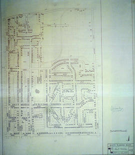
East City of Belleville Map with Property Boundaries in 1976
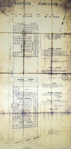
East Gate Subdivision in the City of Belleville
East Park Subdivision in the City of Belleville
Eastview Heights Subdivision in the City of Belleville
Electoral Map of the Province of Ontario
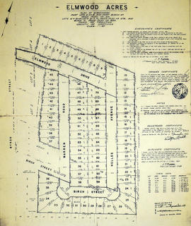
Elmwood Acres Subdivision in the Town of Trenton
Elmwood Burial Ground in the Township of Thurlow
Elzevir Township Map # 446772E
Elzevir Township Map # 446772W
Extensions to Reid Cemetery in the Township of Thurlow
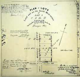
Finnegan Plan of Lots in the Township of Thurlow
Forest Hill Subdivision in the Township of Thurlow
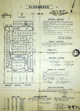
Glenarden Subdivision in the City of Belleville
Results 41 to 60 of 810