Poor reproduction of a sketch of Upper Canada to show places designated by Lt. Gov. Simcoe for towns and proposed military roads, circa 1796. The map was published by B. M. Kings.
This file contains a photocopy of a Deposition by John Walter Myers Esq. dated 14-June-1797 for David Palmer's service in the Corps known by the name of Major Roger's Corp. and that Catharine Harris (wife of David Harris) is David Palmer's legitimate daughter.
File contains a manuscript marriage license dated 24 August 1797 of Mungo Ponton and Grace Nisbet, issued in Edinburgh Scotland in 1798. Also present is a manuscript dinner invitation issued to Captain and Mrs. Ponton by Dr. and Mrs. Burrows, 21 February 1860.
File contains manuscript notes by Mary Plumpton including lists of Thurlow Town Clerks, 1798-1846; transcripts of pages from an unidentified diary 1870-1872, and notes on individuals appearing in Plumpton's work, The Rambling River. Also present is a photocopied printed excerpt from the 1879 Hastings County Directory with entries for Canifton[sic] listing residents by name and occupation.
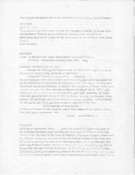
File contains Jezzard family Deed of Sale documents. In 1798 land was sold from Crown land in Hastings County to James McMasters, who then sold land to Joseph Forsyth in 1802, who sold land to Michael Braddeu in 1850.
A copy of an original map by Surveyor General David W. Smith showing several lots of land in Murray Township in the District of Newcastle. Specifically, the map shows Lots 1-5 near the 1st Concession and River Trent. Published by Henry Smith on July 24, 1799.
File contains a photocopied printed extract from Belden's Atlas (1878) reprinted in The City of Belleville History (1943) by W.C, Mikel, concerning the organization of the Hastings County militia in 1799.
Reproduction of: "A plan of the organized part of the Provinces of Upper Canada according to a Bill which has passed the two Houses, & reserved for the signification of the Royal Pleasure." Surveyed by J. R. Grant Surveyor General. Circa 1798-1802.
This collection contains three volumes and a bundle of deeds and mortgages relating to properties in Hastings County.
'Patent Record': volume arranged by township, concession, and lot number, recording the original patent holder and the date of granting for each lot in Hastings County, 1800-1947
'Liber A': the earliest land register book for Hastings County, covering instruments 1-110, 1800-1811 *Printed 'New Topographical Atlas of the Province of Ontario, 1879'
File contains 2 business cards; 1) Glasgow Warehouse (Dry Goods, Carpets, Linoleum & House Furnishings), Belleville and 2) Oak Hall (Clothing), Front Street, Belleville
Reproduction of a map showing new settlements, townships, counties etc.in the province of Upper Canada as of April 12, 1800. The total area spans from Quebec to Lake Huron and from Lake Michigan to New Hampshire then south to Pennsylvania in the U.S.A. This was the first printed map of Upper Canada, showing all settlements since 1784. Charted by D. W. Smith, Esq., Surveyor General London and published by W. Faden.
This map was published by Stonehouse Productions as part of "Charting Our Past" from the Archives of Ontario.
File containing minutes of a meeting of Masons from 5 May 1803, Lodge #06 at Kingston. Also a newspaper clipping on the founding of Lodge 11in Belleville.