Showing 111 results

Archival description
Geographic features With digital objects
Print preview Hierarchy View:
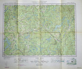
Topographical map of Coe Hill - Canada sheet
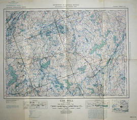
Topographical map of Coe Hill, Ontario
Topographical map of Belleville - east half
Topographical map of Belleville - west half
Topographical map of Bannockburn - Canada sheet
Topographical map of Bancroft - east half
Topographical map of Bancroft - west half
Topographical map of Bancroft - east half
Road Map of Hastings County 1953
Topographic Map of Ontario - Belleville Sheet
Stapley, Forde Samuel Russell/Smith, Sarah Almina/Bird,Kenneth Mulholland
Meyers' Cave
Meyers' Cave
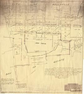
Map of planned Belleville Harbour
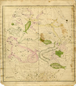
Geography of the Heavens - a Celestial Atlas
Map of the principal settlements of Upper Canada (Part 2)
Map of the principal settlements of Upper Canada (Part 1)
A New Map of Upper & Lower Canada
Road Map of Hastings County 1956
Topographical Map of Belleville - Canada sheet - east half
Results 21 to 40 of 111