2 maps showing geological areas in Madoc (Map No. 2053) and Gananoque (Map No. 2053). Scale 1 in to 2 miles. Booklet by D. F. Hewitt, Senior Geologist, Ontario Department of Mines, Toronto.
Ontario. Ministry of Natural Resources and Forestry
A double sided, folded map showing the location and types of mineral in Ontario. The back side shows photographs of each type of mineral. Published by the Ministry of Industry & Tourism and Ministry of Natural Resources.
Ontario. Ministry of Natural Resources and Forestry
A map of the Napanee Administrative District including Northumberland, Hasting County, Prince Edward County, Lennox Addington counties. Published by the Ministry of Natural Resources in 1980.
Donated by the Belleville Public Library in 2014.
Ontario. Ministry of Natural Resources and Forestry
A map of the Universal Transverse Mercator Grid System covering area in Zone 06 from Havelock to Brockville. Scale 1:250,000. Published by the Ministry of Natural Resources April 1st, 1989.
Ontario. Ministry of Natural Resources and Forestry
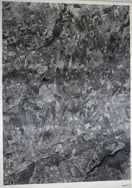
A reproduction of an air survey photograph produced by the Ontario Ministry of Natural Resources. Map # 442773E of Sidney Township in Hastings County, Ontario. Circa 1950.
The photograph shows Sidney Township, Concession 1 to 8, Lots # 1 to 25, Hwy 33 and the Trent Canal and Frankford Village, southeast part of Murray Township.
Donated by Walter I. Watson, P. L. S.
Ontario. Ministry of Natural Resources and Forestry
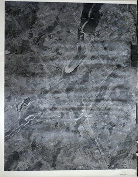
A reproduction of an air survey photograph produced by the Ontario Ministry of Natural Resources. Map # 442773W of Murray Township in Hastings County, Ontario. Circa 1950.
The photograph shows Concession 3 to 10 and Hickory Island of Murray Township, and Lots # 5 to 22, east part of Brighton Township.
Donated by Walter I. Watson, P. L. S.
Ontario. Ministry of Natural Resources and Forestry
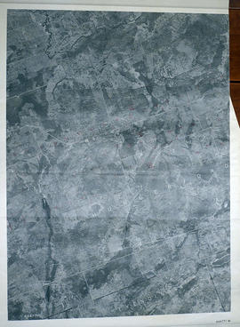
A reproduction of an air survey photograph produced by the Ontario Ministry of Natural Resources. Map #443771E of Richmond Township in Lennox and Addington County, Ontario. Circa 1950.
The photograph shows Richmond Township and the east part of Tyendinaga Township.
Donated by Walter I. Watson, P.L.S.
Ontario. Ministry of Natural Resources and Forestry
A reproduction of an air survey photograph produced by the Ontario Ministry of Natural Resources. Map # 443771W of Tyendinaga Township in Hastings County, Ontario. Circa 1950.
The photograph shows Lonsdale, Melrose and north to Concession 8, Township of Tyendinaga.
Donated by Walter I. Watson, P. L. S.
Ontario. Ministry of Natural Resources and Forestry
A reproduction of an air survey photograph produced by the Ontario Ministry of Natural Resources. Map # 443772E of Thurlow Township in Hastings County, Ontario. Circa 1950.
The photograph shows the east part of Thurlow Township and west part of Tyendinaga Township from Concession 5 to Concession 8.
Donated by Walter I. Watson, P. L. S.
Ontario. Ministry of Natural Resources and Forestry
A reproduction of an air survey photograph produced by the Ontario Ministry of Natural Resources. Map # 443772W of Rawdon Township in Hastings County, Ontario. Circa 1950.
The photograph shows the west part of Rawdon Township and the east part of Huntingdon Township.
Donated by Walter I. Watson, P. L. S.
Ontario. Ministry of Natural Resources and Forestry
A reproduction of an air survey photograph produced by the Ontario Ministry of Natural Resources. Map # 443773E of Rawdon Township in Hastings County, Ontario. Circa 1950.
The photograph shows Glen Ross, Oak Lake, Stirling and north to Concession 7.
Donated by Walter I. Watson, P.L.S.
Ontario. Ministry of Natural Resources and Forestry
A reproduction of an air survey photograph produced by the Ontario Ministry of Natural Resources. Map #443773W of Seymour Township in Northumberland County, Ontario. Circa 1950.
The photograph shows Seymour Township to the 10th Concession, including Percy Reach and Wilson Isle, Northumberland County.
Donated by Walter I. Watson, P.L.S.
Ontario. Ministry of Natural Resources and Forestry
A reproduction of an air survey photograph produced by the Ontario Ministry of Natural Resources. Map #444771E of Sheffield Township in Lennox and Addington County, Ontario. Circa 1950.
The photograph shows the southwest part of Sheffield Township, Concession 1 to 6, Hwy 49, northwest corner of Camden East, northeast corner of Richmond Township and southeast corner of Hungerford with Village of Marlbank and Lime Lake.
Donated by Walter I. Watson, P.L.S.
Ontario. Ministry of Natural Resources and Forestry
A reproduction of an air survey photograph produced by the Ontario Ministry of Natural Resources. Map # 444771W of Hungerford Township in Hastings County, Ontario. Circa 1950.
The photograph shows Hungerford Township from Tyedinaga Township north to Bogart and Claire River.
Donated by Walter I. Watson, P.L.S.
Ontario. Ministry of Natural Resources and Forestry