- CA ON00156 TR/0874
- File
- 1968
File contains a newspaper clipping regarding the 1967 sale of the Cannifton Grist Mill and an article regarding the Cannifton Grist and Sawmill destroyed by fire.
177 results directly related Exclude narrower terms
File contains a newspaper clipping regarding the 1967 sale of the Cannifton Grist Mill and an article regarding the Cannifton Grist and Sawmill destroyed by fire.
Marmora Iron Works : unveiling of plaque, July, 1969
File contains a printed program of events at the unveiling of a historical plaque commemorating the opening of the Marmora Iron Works in Blairton in 1823. Also contains two photocopied engravings of the Blairton Iron Mine.
File contains newspaper clips on Mayor Scott on the industrial expansion of Belleville c.1969, a “Buy Belleville” sticker, and miscellaneous newspaper clips on Belleville expansion.
Belleville Business Report 1969
File contains the “Report on Business” section of the March 4th, 1969 Globe and Mail, featuring an article on Belleville and its slow move to being more commercial and industrialized.
Belleville Industries – new 1969
File contains newspaper clips on the c.1969 proposed Belleville Holiday Inn, Brooks Board Ltd complex to be built in Belleville's industrial park, and miscellaneous clips on Belleville industrial expansion during 1969.
Corby's Distilleries promotional materials
Promotional materials relating to Corby's Distillery in Corbyville, Ontario, collected by William Dack:
1) "A Proud Canadian" sticker
2) Postcard of a boy fishing in the Moira river next to the distillery buildings at Corbyville
3) Card advertising tours of the J.P. Wiser Distillery at Corbyville
4) Six notecards with pen and ink drawings of buildings at the distillery site in Corbyville by Poul Thrane
Corby's Distilleries

News clipping about Hawley Brothers furniture factory
Napanee Beaver
Ontario Aerial photographs 1972-1977
Part of Map collection
Aerial photographs showing various townships within Ontario in the 1970s.

Hedley Derry describes his life in Bancroft, then as a carpenter and finally his life in Trenton. He discusses the lumbering business.
Derry, Hedley Vicker
Part of Map collection
A map showing a zoning limits street plan within the City of Belleville. The zones and symbols can be referenced on the legend. The map was published on February 6, 1974.

Wessman, Sigurd/Wessman, Olive Elsie
Mr. and Mrs. Wessman discuss his tool and die-making business in Deseronto and Belleville.
Wessman, Sigurd

Holgate, Charles Arthur/Myrtle Alice Holgate
Mr. and Mrs. Holgate discuss their life as the owners of a grist and saw mill in Cannifton, setting it up in 1921 and selling it in 1953.
Holgate, Charles Arthur

Clara McGuinness discusses her life in Lonsdale and Deseronto.
McGuinness, Clara Agnes
Newspaper clipping about Hart Brothers and Lazier pottery plant
Cutting from The Advertiser newspaper about Hart & Lazier crockery.
A calendar from Fry Ford Sales Ltd. that showcase cars from the year 1921. Includes illustrations. 12 pages.
DVDs of Corby Distillery film and Vernon's Directory of Belleville, 1940
DVD of promotional film made by Westminster Films for Corby Distilleries in 1977. CD purchased from ArchiveCDBooks with PDF file of the 1940 Vernon's Directory of Belleville, Ontario.
Westminster Films Ltd.
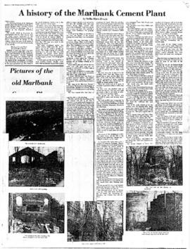
A History of the Marlbank Cement Plant
Photocopy of an article by Stella-Marie Brown, a student at Napanee Secondary School, on the history of the Marlbank Cement Plant, written for an essay contest sponsored by the Lennox and Addington Historical Society and published in The Tweed News on 23 August 1978.
Brown, Stella-Marie
Air Surveys of Belleville, Ontario
Part of Map collection
All air surveys were completed in 1979 and published in 1982. Scale 1; 10,000. By the Ontario Ministry of Natural Resources, Map base by Survey and Mapping Branch, Air Photography.
1) M470-2690. Belleville, Sheet # 1, 10-18-3050-48900 showing areas of; Belleville and surrounding area, from the Bay of Quinte to near Hwy 401. The sheet includes both sides of Wallbridge Loyalist Road and both sides of the River Moira.
2) M470-2691. Belleville, Sheet # 2, 10-18-3050-48950 showing areas of; Belleville, Hwy 401, Cannifton, Corbyville, and Northerly along the Moira River to Concession 5.
3) M470-2692. Belleville, Sheet # 3, 10-18-3100-48900 showing areas of; East Belleville to both sides of Blessington Creek and Northerly from Bay of Quinte to CN Railway.
4) M470-2693. Belleville, Sheet # 4, 10-18-3100-48950 showing areas of; North section of Belleville, North of CNR and North of Hwy 401 including part of Concession 4. The Belleville Airfield is in the South East corner of the map.
Ontario. Ministry of Natural Resources and Forestry
Forestry in the Townships of Hastings and Prince Edward Counties
Part of Map collection
Forestry maps of Ameliasburgh, Murray, Rawdon, Sidney and Thurlow townships from 1980.
Bowles, Roy T. - Deloro And The World The Local Manifestations of the Ontario Mineral Industry
This file contains a paper written by Roy T. Bowles, Department of Sociology, Trent University, Peterborough, Ontario April 1980 and titled "Deloro And The World The Local Manifestations Of The Ontario Mineral Industry . The paper focuses on technological and community patterns which occurred in the village of Deloro, Ontario between 1896 and 1919.