- CA ON00156 M/M440-2084
- Pièce
- c. 2000
Fait partie de Map collection
A map of Quinte West, Ontario featuring streets, waterways and significant buildings - see legend for details.
Sans titre
177 résultats directement liés Exclure les termes spécifiques
Fait partie de Map collection
A map of Quinte West, Ontario featuring streets, waterways and significant buildings - see legend for details.
Sans titre

Geological Map of Madoc Gold Region
Fait partie de Map collection
A Geological Map of the Madoc Gold Region, 1866. Geological data on map was taken principally from the reports of the Geological Survey of Canada. Secondly, by information and facts obtained on the spot by gentlemen engaged in the gold fields. What follows is a description of the general geological character of the area.
Author: Henry White, P.L.S. Published by G. B. Ware, 16 Toronto Street, Toronto, Ontario.
Sans titre
New Boundaries of Belleville in 2005
Fait partie de Map collection
A map of the Belleville featuring new boundaries, circa 2005. Scale: 2cm:1km. Published by the Ontario Mapping Company.
Sans titre

Zoning Map of Belleville 1959-1970
Fait partie de Map collection
A map showing, primarily, zoning limits within the City of Belleville. The limits are coloured in crayon and can be referenced on the legend (left). The map was first created c. 1959 (as written in pencil). However, more recent revisions were made June 4, 1970. Scale: 1:12,000. Additional information about by-laws is available on the map's border.
Note the two names listed on the top left corner: K. Murray and D. Williams - possible authors or owners.
Map of Mineral Exploration in the Wicklow Area
Fait partie de Map collection
A map of mineral exploration in the Wicklow area, Hastings County during 1983. Scale 1:15840. Published by the Ontario Ministry of Natural Resources. Charted by the Ontario Geological Survey.
Insets: legend, symbols, mineral assemblage subcodings, properties and occurrences and marginal notes.
Sans titre
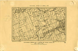
Plan showing Corundum Deposits in Hastings County
Fait partie de Map collection
A plan showing corundum deposits in the townships of Hastings and Renfrew Counties. Published by the Geological Survey of Canada, Counties, Ontario. Dated 1898. Scale: 5 miles to an inch. Autographed "C. O. Senecal."
Received 19 Jul 1911 from Canada Iron Mines, Trenton Office.
Sans titre
Map of Land Ownership and Fish Species in Bancroft-Mazinaw
Fait partie de Map collection
A map describing areas of land ownership and fish species in Bancroft/Mazinaw. The map covers the following townships:
Hastings County: Lake, Tudor & Grimsthorpe
Lennox and Addington County: Ashby, Denbigh, Effingham, Abinger & Anglesea
Frontenac County: Barrie, Clarendon, Miller, North Canonto, South Canonto, & Palmerston
Scale 1cm:1km. Published by the Ontario Ministry of Natural Resources in 1993.
Sans titre
Map of Paleozoic Geology of Kaladar and Tweed
Fait partie de Map collection
A map of the Paleozoic geology featured in the Tweed-Kaladar area during 1981. Scale 1:50,000. Published by the Ontario Ministry of Natural Resources.
Funded by the Federal Department of Regional and Economic Expansion and the Ontario Ministry of Natural Resources under the Minerals Program of Eastern Ontario Subsidiary Agreement.
Sans titre
Forestry in the Townships of Hastings and Prince Edward Counties
Fait partie de Map collection
Forestry maps of Ameliasburgh, Murray, Rawdon, Sidney and Thurlow townships from 1980.
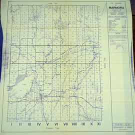
Map of Marmora Township in Hastings County
Fait partie de Map collection
A map of Marmora Township in Hastings County showcasing the mining industry in Eastern Ontario. Concessions and lots are numbered. Plan number E. O. 67 from the Ontario Department of Mines, issued on October 1, 1953. Scale: 1:30,000.
Sans titre

Map of Lake Township in Hastings County
Fait partie de Map collection
A map of Lake Township in Hastings County showcasing the mining industry in Eastern Ontario. Concessions and lots are numbered. Plan number E. O. 57 from the Ontario Department of Mines, issued May 6, 1954. Scale: 1:30,000.
Sans titre
Various items, including:
1) Receipt from McLaughlin Carriage Company addressed to Patrick T. Tighe, June 1st, 1912
2) Operating Rules, Welland Ship Canal Construction Railway, 1914
3) Rules of the Electric Power Company Limited, Belleville, Ontario, c. 1916
4) Notice of Disposition Claim for Exemption, under the Military Service Act, 1917 for Thomas Tighe of Read, Ontario
5) Returned Soldiers' Handbook, May 1918
6) Leave or Duty Ration Book, Thomas Tighe, November 1918
7) Western Scales of Prices Governing Wages in Rolling Mills, June 30, 1920
8) Western Scales of Prices Governing Wages in Rolling Mills, of Maurice Callaghan, June 30, 1921
9) Callaghan's Ice & Wood Tickets, not dated
10) The Navy League of Canada Dominion Council, Seamanship Pocket Manual, 1944
11) 13 colour photographs of a model of a proposed park behind Belleville City Hall, not dated [c. 1980]
12 and 13) Program and song sheet for Victory in Europe concert by the Trentones, May 12th and 13th 1995
14) Unemployment insurance stamps
15) 'The Cooks' Companion' recipe book published by the St. Andrews Club of St. Andrews Presbyterian Church, Belleville, 1932
16) Prize List for World's Fair, Shannonville, September 18th and 19th, 1942
17) Preliminary list of electors for Urban Polling Division No. 9 of Belleville, 1972
18) Agenda and papers of the School Closure Committee of the Hastings County Board of Education, 1992
Sans titre

Minerals in northern Hastings County
Fait partie de Map collection
A map of northern Hastings County detailing different types of mineral occurrences, see Legend. Published in 1943 by the Ontario Department of Mines. Scale: 1:120,000. The map includes parts of Quebec and USA, in relation to the region. It was produced to "accompany report by Jas E. Thomson in Vol. LII Ontario Department of Mines, Annual Report, 1943."
Donated by the Ontario Department of Mines, April 1, 1965.
Sans titre

Fait partie de Map collection
A map of Prince Edward County featuring information about local historical traditions, agriculture, community life and geography. Published in 1937 through Picton Times by Conger Allison. Dimensions: 72cm x 53cm.
Sans titre

Map Hastings, Prince Edward, Northumberland and Peterborough Counties
Fait partie de Map collection
A map of Hastings, Prince Edward, Northumberland and Peterborough counties in 1916 from the Department of Interior Canada. Published by J.E. Chalifour, Chief Geographer. Scale: 3" to 95 miles. Dimensions 63.5cm x 96.5cm.
The legend includes additional information about counties, towns, villages, boundaries, railways, canals, lots, concessions, portages, rapids and First Nations Territories.
Sans titre
Playing with Fire: Trenton and the British Chemical Company
Digital film exploring the history of the British Chemical Company's plant in Trenton, Ontario, and the Trenton Explosion of 14 October 1918.
Sans titre
DVDs of Corby Distillery film and Vernon's Directory of Belleville, 1940
DVD of promotional film made by Westminster Films for Corby Distilleries in 1977. CD purchased from ArchiveCDBooks with PDF file of the 1940 Vernon's Directory of Belleville, Ontario.
Sans titre

Photograph of Canada Cement Company Plant No. 5
Photograph of the Canada Cement Company Plant Number Five at Point Anne.
Sans titre
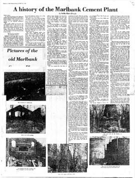
A History of the Marlbank Cement Plant
Photocopy of an article by Stella-Marie Brown, a student at Napanee Secondary School, on the history of the Marlbank Cement Plant, written for an essay contest sponsored by the Lennox and Addington Historical Society and published in The Tweed News on 23 August 1978.
Sans titre
Trenton : miscellaneous news clippings
Fait partie de HCHS Textual Records collection: Files 2500 to 2999
File contains miscellaneous newspaper clippings and photographs relating to aspects of Trenton's history including education, sports, the construction of CFB Trenton and industrial development.