History Project: the Depression of 1929-1939
- CA ON00156 2018-052/28
- Item
- 1974
Text of interviews with:
an individual who lived in Moira, Ontario and was 3 at the beginning of the Depression
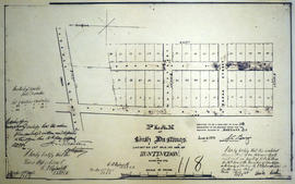
an individual who lived in Huntingdon, Ontario and was 33 at the beginning of the Depression
*a woman who lived on a farm and was 26 at the beginning of the Depression
Reid, Donna