Dungannon, Township of

Référentiel

Code

Note(s) sur la portée et contenu

Note(s) sur la source

Note(s) d'affichage

Termes hiérarchiques

Dungannon, Township of

Terme générique Hastings, County of

Dungannon, Township of

Termes équivalents

Dungannon, Township of

Termes associés

Dungannon, Township of

16 Description archivistique résultats pour Dungannon, Township of

16 résultats directement liés Exclure les termes spécifiques

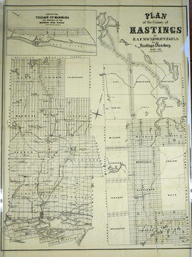
Plan of Hastings for Hastings Directory

  • CA ON00156 M/M420-1080
  • Pièce
  • 1864-1865
  • Fait partie de Map collection

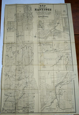
A map of Hastings County outlining townships:
Marmora, Lake, Madoc, Tudor, Grimsthorpe, Elzevir; Rawdon, Huntingdon, Hungerford, Sidney, Thurlow, Tyendinaga - as well as the northern townships.
Inset is "the Village of Marmora." Surveyed by H. A. F. Macleod, C.E. and P.L.S. Published by W. A. Little Lith., Montreal in the 1864-1865 copy of the Hastings Directory . Scale: 1:190,000.

Sans titre

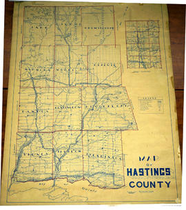
Lloyd's Map of Hastings County

A map of Hastings County outlining the twelve townships:
Marmora and Lake, Madoc, Tudor, Grimsthorpe, Elzevir; Rawdon, Huntingdon, Hungerford, Sidney, Thurlow, Tyendinaga. The northern townships are pictured on the right side.
As well as, the lots and concessions. Circa 1922. Scale: 1.5 miles: 1 inch. Published by Lloyd's Maps, Map Publisher.

Sans titre

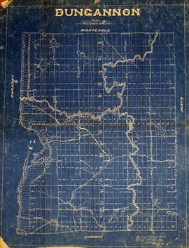
Map of Dungannon Township

  • CA ON00156 M/M420-2169 - 2183/M420-2179
  • Pièce
  • 25 Aug 1864 - 1900
  • Fait partie de Map collection

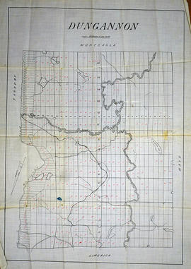
A blueprint reproduction of a map of Dungannon Township in Hastings County, Ontario. The map features the names of neighboring townships, lot and concession numbers, creeks, rivers, and lakes. The Hastings Road borders the west side of the township. Surveyed by T. L.P. O’Hanly, P.L.S., and signed August 25, 1864 at Ottawa. Scale 40 chains to an inch.

The Canadian Northern Railway was added to the map at a later date, succeeding its incorporation in 1899.

Sans titre

Registrar's Plan of Lots 9-10 in the Township of Dungannon

  • CA ON00156 M/M430-2463
  • Pièce
  • 31 May 1970
  • Fait partie de Map collection

A certified reproduction of the "Registrar's Compiled Plan being a graphic index of part of Lots # 9 and 10, Concession 7, Township of Dungannon.” The area includes; Lots # 1 to 15 from road allowance between Concession 6 & 7 Northerly to Railway Lands being part of Lots # 9 & 10, Concession 7, Township of Dungannon. Surveyed by H. Flim, O. L. S. and signed May 31, 1970.

Donated by Walter I. Watson, P. L. S.

Sans titre

Registrar's Plan of Lots 9-10 in the Township of Dungannon

  • CA ON00156 M/M430-2464
  • Pièce
  • 19 May 1970
  • Fait partie de Map collection

A certified reproduction of the "Registrar's Compiled Plan being a graphic index of part of Lots # 9 and 10, Concession 7, Township of Dungannon.” The area includes; Lots # 1 to 30 on West and East shores of Egan Creek, from road allowance between Concession 6 & 7, Northerly to Railway Lands, being part of Lots # 9 & 10, Concession 7, Township of Dungannon. Surveyed by H. Flim, O. L. S. and signed May 19, 1970.

Donated by Walter I. Watson, P. L. S.

Sans titre

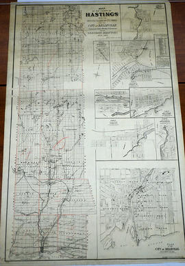
Map of Hastings with the Principal Villages and the City of Belleville

  • CA ON00156 M/M420-1088
  • Pièce
  • 1879-1880
  • Fait partie de Map collection

A map of Hastings County including the Town of Belleville and other principal villages:

Trenton, Madoc, Marmora, Tweed, Bridgewater, Stirling, Wicklow, Bangor, Herschel, Monteagle, Carl, Dungannon, Wollaston, Limerick, Cashel, Tudor, Grimsthorpe, Elzevir; Rawdon, Huntingdon, Hungerford, Sidney, Thurlow, Tyendinaga.

Scale: 3 miles =1 inch. Published by Evans & Bolger, P. L. Surveyors, P.L.S. in 1879-1880.

Sans titre

Map of Hastings with townships

A map of Hastings County outlining the twelve townships:
Marmora and Lake, Madoc, Tudor, Grimsthorpe, Elzevir; Rawdon, Huntingdon, Hungerford, Sidney, Thurlow, Tyendinaga.
As well as, the lots and concessions. Circa 1916.Scale: 4 miles: 1 inch.

Donated by K.G.M. Ross.

Dungannon & Farraday

File contains a petition to the Councillors of Hastings County from the inhabitants of Dungannon and Faraday Townships concerning the division of the townships into three school sections. Also contains a directive from the Municipal Council, Hastings County concerning fencing in Dungannon and Faraday Townships.

Hastings with Town of Belleville and principal villages

A map of Hastings County including the Town of Belleville and other principal villages:

Trenton, Madoc, Marmora, Tweed, Bridgewater, Stirling, Wicklow, Bangor, Herschel, Monteagle, Carl, Dungannon, Wollaston, Limerick, Cashel, Tudor, Grimsthorpe, Elzevir; Rawdon, Huntingdon, Hungerford, Sidney, Thurlow, Tyendinaga.

Scale: 3 miles =1 inch. Published by John P. Evans, P.L.S. in 1869.

Sans titre

Map of Dungannon Township

  • CA ON00156 M/M420-2169 - 2183/M420-2178
  • Pièce
  • c. 1880
  • Fait partie de Map collection

An original waxed linen map of Dungannon Township in Hastings County, Ontario. The map features the names of neighboring townships, lot and concession numbers, creeks, rivers, lakes and the Central Ontario Railway. Some lots have a red ink “P” written on. The Hastings Road borders the west side of the township. Circa 1880.

Dungannon Township : Turriff history

File contains original and photocopied typescript notes prepared by Mrs. Alex McGibbon, L'Amable, concerning the history of the southern section of Dungannon Township and the settlement of Turriff, with additional notes by Mrs Herbert Hawkins on the history of Bronson Settlement, Dungannon Township, Hastings.