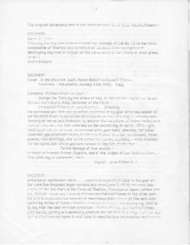
Survey – First survey of Thurlow 1799
- CA ON00156 TR/0694
- Unidad documental compuesta
- 1799
File contains a photocopy of the first survey of Thurlow.
133 resultados directamente relacionados Excluir términos relacionados
Survey – First survey of Thurlow 1799
File contains a photocopy of the first survey of Thurlow.
File contains a photocopied printed extract from Belden's Atlas (1878) reprinted in The City of Belleville History (1943) by W.C, Mikel, concerning the organization of the Hastings County militia in 1799.
Sin título
File contains a brief photocopied, printed essay on farming in the early nineteenth century.
The Belleville Gas Company of Hastings
File contains a copy of a blank receipt for the purchase of Capital Stock of the Belleville Gas Company of Hastings, Ontario.

Reproduction of a plan of the organized part of the Provinces of Upper Canada
Parte deMap collection
Reproduction of: "A plan of the organized part of the Provinces of Upper Canada according to a Bill which has passed the two Houses, & reserved for the signification of the Royal Pleasure." Surveyed by J. R. Grant Surveyor General. Circa 1798-1802.
Part of the Mika collection.
Hastings Land Registry materials
This collection contains three volumes and a bundle of deeds and mortgages relating to properties in Hastings County.
'Patent Record': volume arranged by township, concession, and lot number, recording the original patent holder and the date of granting for each lot in Hastings County, 1800-1947
'Liber A': the earliest land register book for Hastings County, covering instruments 1-110, 1800-1811
*Printed 'New Topographical Atlas of the Province of Ontario, 1879'
Sin título
File contains 2 business cards; 1) Glasgow Warehouse (Dry Goods, Carpets, Linoleum & House Furnishings), Belleville and 2) Oak Hall (Clothing), Front Street, Belleville

Reproduction of a map of the province of Upper Canada
Parte deMap collection
Reproduction of a map showing new settlements, townships, counties etc.in the province of Upper Canada as of April 12, 1800. The total area spans from Quebec to Lake Huron and from Lake Michigan to New Hampshire then south to Pennsylvania in the U.S.A. This was the first printed map of Upper Canada, showing all settlements since 1784. Charted by D. W. Smith, Esq., Surveyor General London and published by W. Faden.
This map was published by Stonehouse Productions as part of "Charting Our Past" from the Archives of Ontario.
Sin título

Survey of the First Loyalists Settlement
Parte deMap collection
A reproduction of a survey of one the first Loyalists Settlement in Upper Canada.
Part of the Mika collection (HCM05682).
Masonic : Moira Lodge list of past masters, 1801-1963
File contains a photocopied printed pamphlet listing the annual past masters of the Moira Lodge of the Masons, 1801-1963.
Missionary Lorenzo Dow 1801-1829
File contains newspaper clips of Lorenze Dow's journal with excerpts from ca.1801 and 1829 on his crossing into Canada.
Various notes and legal documents relating to Russell and Thomas Pitman of Thurlow Township, Hastings County. Partially transcribed by Lois Foster.
Sin título
Masonic; minutes of instruction 1803
File containing minutes of a meeting of Masons from 5 May 1803, Lodge #06 at Kingston. Also a newspaper clipping on the founding of Lodge 11in Belleville.
Thurlow : Carmel & Bethany Churches
File contains a two-page manuscript account of the history of Carmel, and Bethany United Churches in Thurlow Township.
Land Papers - Martin Foster, Thurlow
Collection of deeds, Martin Foster, lot 7, concession 5, Thurlow Township; property registered before 1790.
Land Papers - Jacob Gough, Huntingdon Township
Grant for Jacob Gough, concession 12, lot 9, Huntingdon Township.
Abstract of Title; Lot 233, George Street, Trenton, Ontario
The file contains an Abstract of Title for the east one third of Lot #233, on the south side of George Street in the Town of Trenton, from 1804 to 1939.
Hastings Militia : officers, 1804-1815
File contains a typescript list of the officers of the 1st regiment of the Hastings Militia by rank, 1804-1815.

Financial and property records relating to the W. R. Prentice store in Foxboro, Ontario, operated by William Robert Prentice and his wife Adelia.
Sin título

A New Map of Upper & Lower Canada
Parte deMap collection
A "New Map of Upper & Lower Canada" published December 1, 1807. Scale: British statute 69.5 miles to a degree. Created by John Cary, engraver and map-seller, No. 181 strand, London.
Sin título