Canada

Taxonomy

Code

Scope note(s)

Source note(s)

Display note(s)

Equivalent terms

Canada

Associated terms

Canada

6090 Archival description results for Canada

133 results directly related Exclude narrower terms

37 Polling Subdivisions of Belleville

A map showing the 37 polling subdivisions of Belleville, Hastings County, Ontario. Composed by Charles Mott from the City in August 1958 and published in The Ontario Intelligencer on 28 November 1958.

Mott, Charles Allan

A Close Up of Southern Ontario, Ontario, and Canada

  • CA ON00156 M/M400-3036, 3038 - 3041, 3044/M400-3036
  • Item
  • Dec 1978
  • Part of Map collection

A map entitled "A Close Up of Southern Ontario, Ontario, and Canada" by the National Geographic Society's Cartography Section. Scale: 1 centimeter = 30 kilometers or 1 inch = 47.3 miles. Dated December 1978.

National Geographic Society

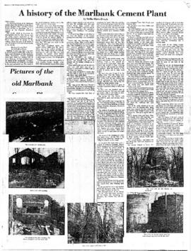
A History of the Marlbank Cement Plant

  • CA ON00156 2018-055
  • Item
  • 1978

Photocopy of an article by Stella-Marie Brown, a student at Napanee Secondary School, on the history of the Marlbank Cement Plant, written for an essay contest sponsored by the Lennox and Addington Historical Society and published in The Tweed News on 23 August 1978.

Brown, Stella-Marie

A Map of Canada, 1972

  • CA ON00156 M/M400-3036, 3038 - 3041, 3044/M400-3044
  • Item
  • Mar 1972
  • Part of Map collection

A map of all of Canada, by the National Geographic Society's Cartography Section. Scale: 1;7460,000 or 117.7 miles to the inch. Dated March 1972.

National Geographic Society

A Map of Canada, 1985

  • CA ON00156 M/M400-3036, 3038 - 3041, 3044/M400-3038
  • Item
  • Nov 1985
  • Part of Map collection

A map showing all of Canada by the National Geographic Society's Cartography Section. Scale: 1 centimeter = 69 kilometers or 1 inch = 109 miles. Dated November 1985.

National Geographic Society

A Map of the Atlantic Gateways

  • CA ON00156 M/M400-3036, 3038 - 3041, 3044/M400-3041
  • Item
  • Mar 1983
  • Part of Map collection

A map showing the gateways of the Atlantic Ocean in North America, by the National Geographic Society's Cartography Section. Scale: 1 centimeter = 13.2 kilometers or 1 inch= 20.8 miles. Dated March 1983.

National Geographic Society

A map of the Boreal Forest of Canada

A map of all of Canada and the boreal forest included within. Additional environmental information can be found on the borders. Composed by the Canadian Department of Natural Resources. Published by Canadian Geographic in 1996.

Canada. Department of Natural Resources

A Map of the Great Lakes

  • CA ON00156 M/M400-3036, 3038 - 3041, 3044/M400-3040
  • Item
  • Jul 1987
  • Part of Map collection

A map showing the Great Lakes of Canada and the USA, by the National Geographic Society's Cartography Section. The totally area shown includes west Manitoba to east Quebec and north to Lake Nipigon and south to U. S. A. Scale: 1 centimeter = 23 kilometers or 1 inch = 36 miles. Dated July 1987.

National Geographic Society

A. McLean Haig records

  • CA ON00156 TR 3305
  • Fonds
  • 1903-1975

This fonds contains 22 folders. It consists of A. McLean Haig's biographical data which includes a brief summary of his life. The second folder contains his incoming correspondence which includes letters from: Assistant Deputy Minister of national Defence James A. Sharpe; a copy of a letter forwarded to Haig from C.C. Wimperly of the Ministry of Municipal Affairs to Mr. A.B. Sprague; two letters between Wimperly and Haig, one with statistics concerning Northumberland and Durham Counties, the communities of Campbellford and Seymour, and the former District of Newcastle; one from A.R. Wilson, the Belleville Superintendent of the Canadian National Railway; one telegram and one business card congratulating Mayor Haig on his election in 1962 from Quebec Premiere Jean Lesage – in the telegram, it is interesting to note that Lesage is spelled Lesarge; a letter from Trans-Canada Air Lines and Air Canada Vice President Howard Cotterell with a small picture sent from Cotterell to Haig from the air carrier's annual report; a letter from CNR Rideau Manager Keith Hunt that had a piece of the rail-track from Pinnacle Street in Belleville enclosed with it after the line had been pulled from the ground in 1964; and three Christmas cards received from constituents.

The are also pieces of Haig's outgoing correspondence including: four pieces of correspondence to CNR the St. Lawrence Region Vice President, W.H. Kyle and Belleville Superintendent A.R. Wilson respectively; and a letter thanking Premiere Lesage – again spelled Lesarge, for his congratulations on winning the 1962 Belleville municipal election.

There is a folder of his municipal papers consisting of: newspaper clippings; a press release from Postmaster M.A. Murray; a program from the opening of the new wing of the Belleville General Hospital in 1956; and a report on major accomplishments achieved by the Haig administration between 1960 and 1963 prepared by City Manager J.R. Reynolds. Additional folders in this fonds include: one folder of federal government papers, nine folders containing copies of his addresses and speeches; one folder of speeches given by other people that the Mayor kept; a folder with copies of the report of the Willmott Royal Commission which looked into the McFarlands hockey team scandal and the City Auditor's report of 1959; one folder of military related documents; one folder with items pertaining to the history of Belleville and Thurlow; a file with printed jokes and other items that Haig found humourous; one folder labeled miscellaneous by the original record keeper; and the contents of a scrapbook.

Haig, A. McLean

A New and Accurate Map of Part of North America

A reproduction of "A New and Accurate Map of Part of North-America, Comprehending the Provinces of New England, New York, Pennsilvania, New Jersey, Connecticut, Rhode Island & Part of Virginia, Canada and Halifax, For the Illustration of M. Peter Kalms Travels." Written at the bottom is "Publish'd according to Act of Parliament Mrahc 7th, 1771."

A New Map of Upper & Lower Canada

A "New Map of Upper & Lower Canada" published December 1, 1807. Scale: British statute 69.5 miles to a degree. Created by John Cary, engraver and map-seller, No. 181 strand, London.

Cary, John

Results 41 to 60 of 6090