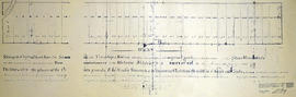
Belleville Planning Board – Front St. 1870
- CA ON00156 TR/0637-1
- File
- 1870
File contains 1870 map of certified plans for lot #32, by David Williams
52 results directly related Exclude narrower terms
Belleville Planning Board – Front St. 1870
File contains 1870 map of certified plans for lot #32, by David Williams
Belleville Ross Block Deeds & Mortgages
File contains originals of Registry Office, County of Hastings, Belleville, dated April 3rd, 1891 “an abstract of all instruments which appear to have been registered in this office upon part of lots twelve and thirteen on the east side of John Street on plan of Ross’ Block laid out on part of lot 5 Con 1 Thurlow” from 1869 through to 1909 also contains original mortgages and deeds:
Belleville treasurer sale of lands
File contains a list of Treasurer's sale of lands c. 1890.
Belleville zoning by-law and map 1953
File contains City of Belleville zoning by-law 6495 and a zoning map of Belleville.
City of Belleville
Belleville, 1816 town lots, decree
File contains a copy of the 1816 town lots decree in Belleville.

Bird's Eye View Map of Belleville
Part of Map collection
Reproduction by the Hastings County Historical Society of an 1874 Bird's Eye View of Belleville, Ontario, showing buildings that existed at that time.
The original map was drawn by Herman Brosius and printed by Charles Sober & Co. of Chicago.

Bird's Eye View Map of Napanee
Part of Map collection
Reproduction of an 1874 Bird's Eye View of Napanee, Ontario, showing buildings that existed at that time. The original map was drawn by Herman Brosius and printed by Charles Sober & Co. of Chicago.
Donated by the Belleville Public Library in 2014.
Block/Coding Index for the City of Belleville
Part of Map collection
A Block/Coding Index for the City of Belleville. Published by the Belleville and Suburban Planning Board - August 18, 1970. Scale 1 inch to 400 feet.
Donated by the Belleville Public Library in 2014.
Belleville and Suburban Planning Board

Blueprint of CNR Right of Way in Belleville
Part of Map collection
A blueprint plan showing land required by the Canadian Northern Ontario Railway for a proposed right-of-way on Lots 1-2A, Dundas Street, Belleville. The property belonging to Mary E. Ponton is coloured in pink and amounts to 1.05 acres. The plan was signed on October 23, 1911 at Toronto.
Stewart, A. F.
Bolger, Thomas Oliver - Provincial Land Surveyor
File contains an original copy of a Report on Mining Lands, in Marmora & Elzevir, County of Hastings by Thomas Oliver Bolger, Provincial Land Surveyor, circa 1850
Bolger, Thomas Oliver, P.L.S.
Booklet "Over the Hills of Hastings"
This file contains a booklet titled "Over the Hills of Hastings" published in 1923 with the intent to bring attention to the advantages of Hastings County. It contains a brief history of the county, also featuring natural resources in the area, a description of the townships within the county and of Belleville and includes a map of Hasting County .

Boundary Lines Survey of Sidney Township, Con. 1
Part of Map collection
A certified reproduction of the “Boundary Line Commissioners Survey of Sidney Township. First Concession and Broken Front, for the Victoria District.” The area contained includes; Sidney Township, Concession 1 and the Broken Front Lots # 5 to 38. Originally surveyed by John Emereson, P. L. S. and produced on June 6, 1841. This reproduction was made by the Archives of Ontario.
Donated by Walter I. Watson, P. L. S.
Emerson, John, P.L.S.
Boundary Lines Survey of Sidney Township, Con. 2
Part of Map collection
A certified reproduction of the “Boundary Line Commissioners Survey of the Second Concession of Sidney, for the Victoria District..” The area contained includes; Sidney Township, Concession 2, Lot Block A and Lots # 1 to 38. Originally surveyed by John Emerson, P. L. S. and produced on September 4, 1840. This reproduction was made on June 2, 1972 and approved by the Deputy Registrar.
Donated by Walter I. Watson, P. L. S.
Emerson, John, P.L.S.

Boundary Lines Survey of Sidney Township, Con. 3
Part of Map collection
A certified reproduction of the “Boundary Line Commissioners Survey of the Third Concession of Sidney, for the Victoria District.” The area contained includes; Sidney Township, Concession 3, Lots: Block A and Lots # 1 to 38. Originally surveyed by John Emerson, P. L. S. and produced circa 1841. This reproduction was made on June 5, 1972 and approved by the Deputy Registrar.
Donated by Walter I. Watson, P. L. S.
Emerson, John, P.L.S.

Boundary Lines Survey of Sidney Township, Con. 5
Part of Map collection
A certified reproduction of the “Boundary Line Commissioners Survey of the Fifth Concession of Sidney, for the Victoria District.” The area contained includes; Concession 5, Lot Block A and Lots # 1 to 32. Originally surveyed by Samuel M. Benson, D. P. S. and produced on November 25, 1840.
This reproduction was made on June 5, 1972 and approved by the Deputy Registrar.
Donated by Walter I. Watson, P. L. S.
Benson, Samuel Manson, D.P.S. & P.L.S.

Boundary Lines Survey of Sidney Township, Con. 9
Part of Map collection
A certified reproduction of the “Boundary Line Commissioners Survey of the 9th Concession of Sidney, for the Victoria District.” The area contained includes; the 9th Concession of Sidney Township, Block A and Lots # 1 to 38.. Originally surveyed by John Emerson D. P. S. and produced on July 18, 1842.
This reproduction was made on June 5, 1972 and approved by the Deputy Registrar.
Donated by Walter I. Watson, P. L. S.
Emerson, John, P.L.S.

Boundary Lines Survey of Thurlow
Part of Map collection
A certified reproduction of the “Boundary Line Commissioners Survey, Concession 1, Township of Thurlow, for the Victoria District.” The area contained includes; Thurlow Township, Concession 1, Lots # 5 to 31 and the Tyendinaga Mohawk Territory on the Southerly part of Lots # 28, 29, 30, 31 along the bayshore. Originally surveyed by John Emereson, P. L. S. and produced on December 27, 1841. This reproduction was made on June 5, 1972.
Donated by Walter I. Watson, P. L. S.
Emerson, John, P.L.S.
File contains biographical information of Anthony Burgess, an immigrant from Portugal who lived in Thurlow and was a sheep breeder in the 1870s.

Burttdale Heights subdivision in Trenton
Part of Map collection
A certified reproduction of the "Burttdale Heights subdivision of Lots # 19 to 28 on East side of Reid Street. Reg'd plan no. 240, Trenton.” The area includes; Lots # 1 to 168, Block A-D, east of Reid Street and south of Hamilton Road, being Lot # 1 Concession 1, Township of Sidney. Surveyed by Ronald Benn, O. L. S. and signed October 14, 1964.
Donated by Walter I. Watson, P. L. S.
Benn, Ronald, O.L.S.

By-law Map #3 of the City of Bellleville
Part of Map collection
A by-law map for the City of Belleville covering area from the Bay of Quinte to College Street & the Moira River to Sidney Street. Initially dated April 4, 1977 but revised later on October 2, 1996. Complied by the Quinte Planning Board. Scale 1;4800. Signed by Mayor J. Ben Corke and Clerk Earl M. Dafoe.
Donated by Lois Foster.
Quinte Planning Board